The Australian Place Names Knowledge Graph brings together the official placenames from every Australian state and territory into a single, national knowledge graph for the first time.
The initiative, led by GKL PhD student Nayomi Ranamuka, aims to demonstrate the power of knowledge graphs for spatial data, showing how knowledge graphs overcome many of the limitations of traditional GIS approaches.
For example, in a knowledge graph, there is no need for layers. Points, lines, and polygons all exist together, linked through meaning rather than file structure. What was nearly a dozen separate GIS layers, each with its own data schema and assumptions, becomes a single, integrated graph of placenames for all of Australia.
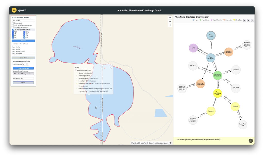
Historical and alternative names are integrated too, allowing you to move with confidence between different names for the same place. And because each state and territory defines and structures placename data slightly differently, the knowledge graph helps untangle legacy data silos to create a national placename knowledge graph that captures and represents the real complexity of Australia’s official placenames.
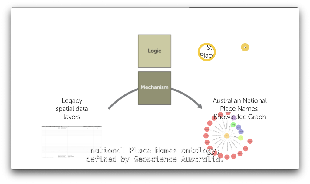
The key to building the knowledge graph lies in the technology we developed to transparently and efficiently map legacy data files to the standard, national placenames ontology, defined by Geoscience Australia. In her PhD research, GKL researcher Nayomi Ranamuka is exploring how to make this critical translation more scalable, more transparent, and more reusable.
The knowledge graph itself is stored on an Apache Jena graph database, with spatial indexing helping to support efficient spatial queries. The Team is also very grateful for the outstanding technical support of the RMIT Advanced Cloud Ecosystem (RACE) team, in helping to scale the application from a research prototype, to a public website.